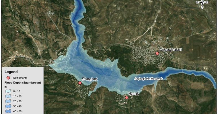
Behind ALTER’s WebGIS System – Part 2: Flood Modeling
This is the second in a series of articles that focuses on the development of both the webGIS system and the complex hydrological models. The system empowers decision makers to better understand risks to their communities and create plans to mitigate and ultimately minimize risk. […]

